New York City maps, rectified
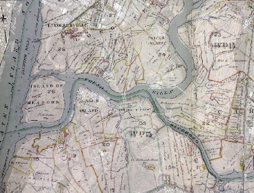
The New York Public Library (NYPL) has unveiled a beta version of their map rectifier tool, a feature that allows users to digitally align or “rectify” historical maps from the NYPL collection with today’s maps and aerial photos. You can browse previously rectified maps or sign up for an account to align your own and add it to the browse-able archive. A 1907 map of the Fresh Kills area helped us understand a little more clearly the extent of filling in creeks and wetlands, and also the sense of private ownership that this land did, in fact, enjoy prior to the start of landfill operations–the entire site was carved up into privately owned parcels.


